K2 BASE CAMP & GONDOGORO LA TREK (19 Days) 2024


Adult Price
Child Price
Visit City
Tour Type
Duration
Pickup Included
Dropoff Included
Guided Tour
Guide Language
K2 BASE CAMP & GONDOGORO LA TREK (19 Days) 2024
Description :
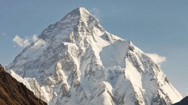
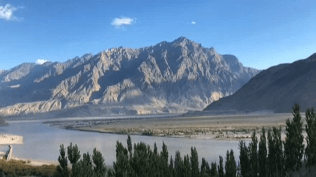
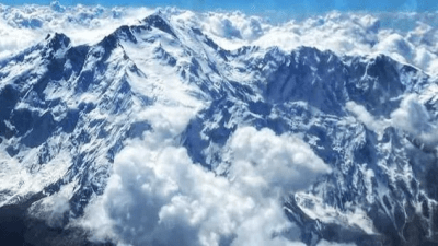
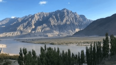
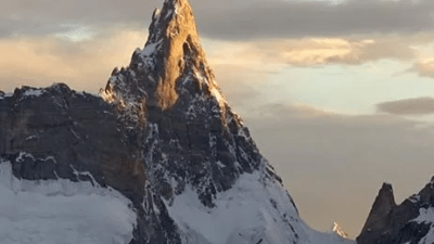
Skardu, nestled in Pakistan's Gilgit-Baltistan region, is a gateway to K2, the world's second-highest peak. It sits at an altitude of 2,228 meters (7,310 feet), surrounded by stunning landscapes of mountains, rivers, and valleys. Skardu offers attractions like the historic Skardu Fort and adventure activities such as trekking and mountaineering. K2 Base Camp, particularly Concordia, lies at the confluence of Baltoro Glacier and Godwin-Austen Glacier. Trekkers start their journey from Askole village, passing through campsites like Paiju and Goro II. The trek offers breathtaking views of K2 and other majestic peaks, but it's challenging and demands physical fitness and readiness for variable weather conditions.
Day 1 (welcome at islamabad airport)

Arrive at Islamabad International Airport.
Day 2 (Flight to Skardu)
Early hours transfer to airport for flight to Skardu, which is very spectacular mountain flight but very dependent on weather conditions. Alternately, we take two day drive to Skardu, along the Karakorum Highway. We stay overnight at Chilas, over heading by the Nanga Parbat, the second highest peak in Pakistan.
Day 3 (Skardu (2350m))
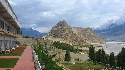
In case the flight operate than we have a free day for sight-seeing, acclimatization and preparations at Skardu, the capital of Baltistan and the gateway to great Karakorum mountains.
If we are driving the road journey today will be 7-8 hrs to Skardu (275km) along the Indus River. On route are spectacular views of Nanga Parbat (8125m), Haramosh peaks, etc. Afternoon briefing in the Ministry of Tourism, Skardu.Meals and overnight hotel.
Day 4 (Drive to Askoli (3050m))
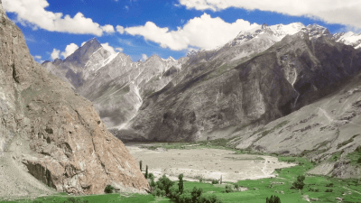
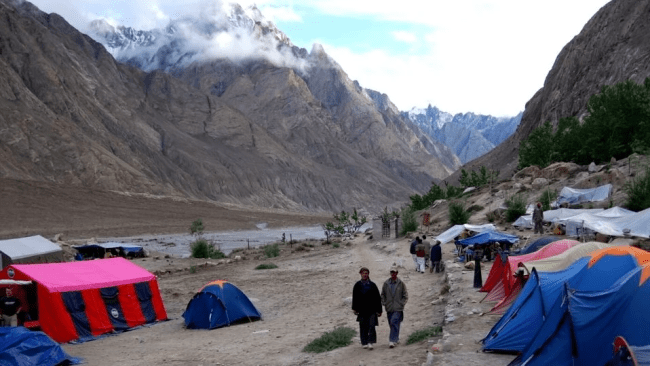
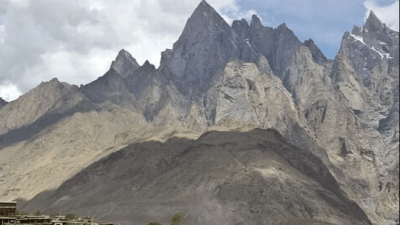
Having an early breakfast we start our jeep journey(7-8 hrs) along the Shigar and Braldu valleys to Askoli village (3050m), the last permanent settlement of Shigar Valley. This seven hours hard drive is an extremely spectacular and fascinating journey through little changed traditional villages and orchards. Overnight in tents.
Day 5 (Trek to Jhola (3200m))

After an early breakfast and distribution of luggage among porters, we start the trek (6 hrs) and walk along the turbulent waters of the Braldu River towards Jhola(3200m). Most of the trek is an easy walk on established trails except the rocky snout of the Biafo Glacier which we cross and continue to up to Jhola camp site situated just after the confluence of the Braldu and Dumordo Rivers. Meals and overnight in tents.
Day 6 (Trek To Paiju (3450m))
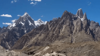
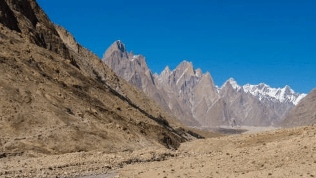
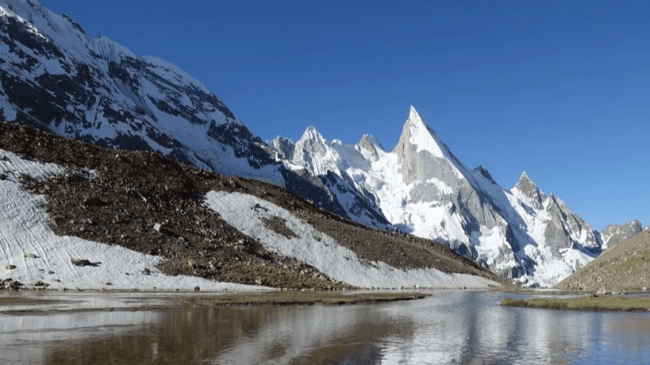
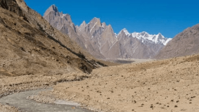
We leave Jhola early for Paiju (3450m). Most of the way is easy mainly at riverside of Braldu River. 7 - 8 hours walking in a hot and dry conditions and crossing many side streams we will reach Paiju afternoon. The Masherbrum group on our right side and whilst ahead of us we gradually begin to see the spires and towers of Trango and Cathedral groups. Today we will also see the snout of the Baltoro Glacier. Dinner and overnight in tents.
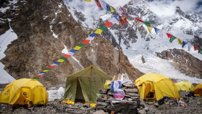
Day 7 (Paiju)
A relaxation, acclimatization and preparations day at Paiju. Meals and overnight in tents.
Day 8 (Horbose (3795m)

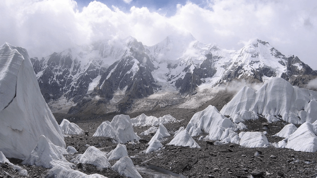
Today From our camp at Paiju, a walk of approximately one hour brings us to the snout of the Baltoro Glacier. we will cross the Baltoro Glacier which is hard but rewarding with the fascinating views of Paiju Peak, Trango Towers, Lobsang Spires, Grand Cathedral, UliBiafo and many other needles like rock peaks we arrive at our camp for the night at Horbose (3795m) A great day of trekking over difficult and mixed terrain.
Day 9 (Trek to Urdukas (4200m))
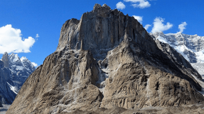
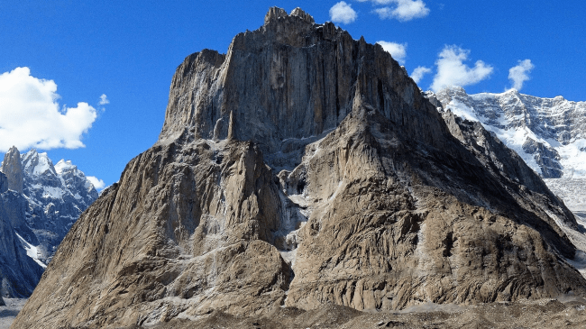
We continue east beside the Baltoro Glacier either along the lateral moraine or sometimes on the glacier itself, passing the ship-like prow of Great Trango and the isolated pillar of the 'Nameless Tower' to our next camp at Urdukas (4200m). This campsite is perched a hundred metres above the glacier on terraces originally hacked out of the hillside by the Duke of Abruzzi's K2 expedition of 1909.. We should reach here in time for a late lunch and the rest of the afternoon is free to tend to camp chores or just to soak up our fabulous situation. Meals and overnight in tents.
Day 10 (Trek to Goro (4300m))
Trek to Goro from Urdukas is easy due to the bare glacier. There are breathtaking views all around us. Heading ahead there are Broad Peak (8047m) and Gasherbrum IV (7925m) on the right side the Mashabrum Group and the left the Trango group of peaks situated. 4-5 hours trekking and overnight in tents.
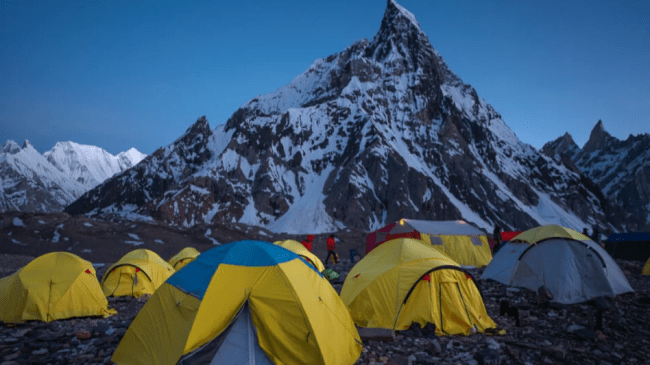
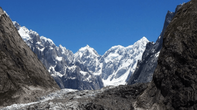
Day 11 (Trek to Concordia (4650m))
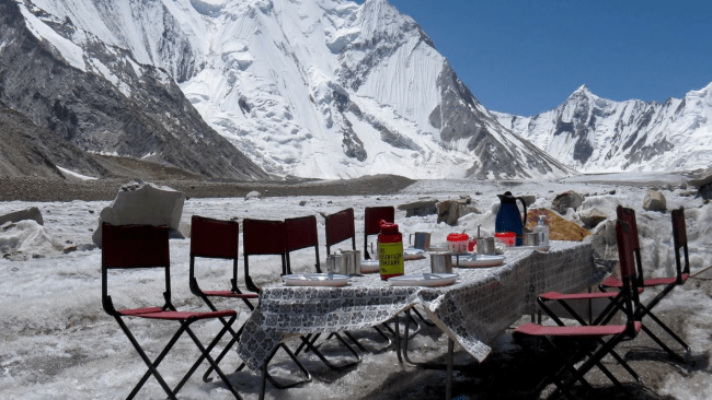
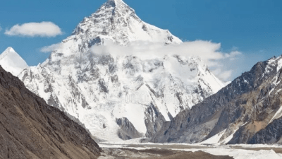
After three to four trek, today, we will reach Concordia, the Throne Room of the Mountain Gods. All around us guarding by the world’s highest peaks including the K2 (8611m) the second highest mountain in the world, Gasherbrum I (8068m), Broad Peak(8047m), Gashabrum-II (8035m) and Chogolisa (7665m). We will camp at the confluence of the Baltoro and Godwin Austin Glaciers
Day 12 (Rest/Exploration Day)
A free day at Concordia can be used to trek up to K-2 BC
Day 13 (Ali Camp)
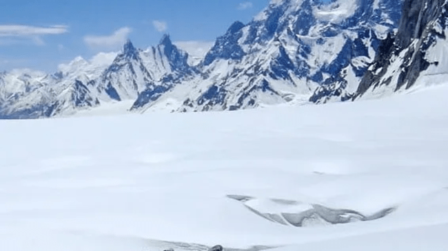
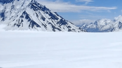
The first two hours of the trek are difficult as We leave base camp and traverse the Baltoro Glacier and its crevasses. One on the Vigne Glacier. It's a comparatively easy and gradual walk over snow and ice, Mighty Chogolisa (25,110) stand's guard in the south. Camp overnight at Ali camp (16,600), a combination of the small rocky platforms between the cliff face and crevasse. We turn in early, as we have a midnight wake-up call for the departure over the Gondogoro La. Five to six hours hiking.
Day 14 (Gondogoro La)

Khuispan. We leave camp at about 3:00am to climb the Gondogoro La 5700 m. As we get closer to the pass we shift on snow until the base of the pass. The final ascent involves a steep walk on snow and, depending on conditions, the use of fixed ropes as well as crampons and ice axes. The views from the top of the pass are unparalleled with K2 Broad Peak. Gasherbrum I to IV, Masherbrum, and many other mountains appear at our level. The descent on the Hushe side is Steeper, requiring god guidance on the rocks. Camp at Khuispan (15,416), a level green spot that has wildflowers.
Day 15 (Khuispan)
A rest day after the ascent of the pass. We can take time to explore the area or just relax and admire views of Lailal Peak (920,00). Drangra (20,746) and Tasa Peak (21,694).
Day 16 (Saischo)
As we leave Xuspang, we make a long traverse of the Gondogoro Glacier, first encountering small crevasses, and then hiking over the soft ice of the Glacier. The last half hour is a pleasant stroll through wildflowers with commanding views of the Gondogoro Glacier, Yermanad Kangri, Masherbrum South, and the Masherbrum La Camp by two small lakes. At we continue, we gradually leave the icy landscapes and descend to the meadow
and pasturland at Saischo. Although we have left the icy wilds, we still have tremendous views of the mountains including Namika Peak and Defo Khar. Four to six hours hiking.
Day 17 (Hushe)
Descend to the Gondogoro River, enjoying spectacular views of K-6 (23,881ft), K-7 (22,744ft), and Link Sar (23094ft). We continue to descend passing through small summer settlements en route to the green irrigated fields at Hushe (10,500ft). three to four hours of hiking.
Day 18 (By jeep to Skardu)
Meet with jeeps and drive six to eight hours to Skardu, passing through many picturesque villages perched on vertical rocks like Amin Brakk Changi Tower, etc. This part of Baltistan appears greener and more prosperous than on our drive to Askole.
Day 19 (Return to Islamabad)

Fly from Skardu to Islamabad, conditions permitting, or make a two-day drive on the Karakorum Highway. Transfer to hotel.